We have been watching the pattern of the North Atlantic weather for the past month, in preparation for our coming trip across the pond. NOAA continues to create new web based products to ease the mariner’s job one of which is a URL with the complete fax run in one document (http://www.opc.ncep.noaa.gov/shtml/A_brief.shtml).
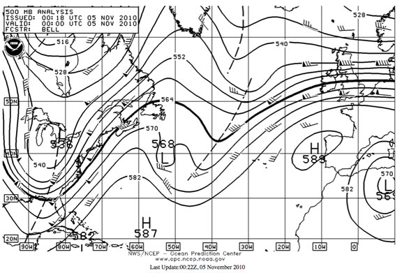
Last night and again this morning the 500mb chart showed rigorous upper level troughs at both ends of the Atlantic. (since the weather we experience at the surface starts in the upper atmosphere, understanding 500mb charts is of critical importance).
In this case, the two troughs shown above, rotated as they are to the west, promise real blows in the next day or two as they rotate to the east.

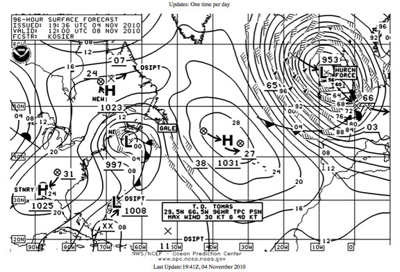
Now the last chart in the series, 96 hours from now. Check out the blow forecast for Biscay, the British Isles, and Western Europe. If you were in Portugal or Northwest Spain this would not be the time to be heading to sea!
A few days ago the 500mb chart showed what is called “zonal” flow – no troughs, just west to east flow. This is highly unstable and often leads to the type of situation we have now, especially in the equinoctial gale seasons. That zonal flow was an early warning indicator of risk.
Although you rarely hear sailors or weather pros discuss the 500mb level, it holds the key t o your comfort and security.
Keep an eye on things the next few days. They could get interesting!

November 6th, 2010 at 10:58 am
Hey Steve,
Thanks for the weather blogs now and again. Checked out the 500 MB charts on the 6th. What do you make of the strong upper level jet over the Eastern US? Looks like it will effect several of the systems along the eastern seaboard.
Cheers
Mike
November 6th, 2010 at 5:26 pm
Hi Mike:
The trough shown digging south is going to create some breeze. I this short wave trough acts in concert with the long wave trough that typically lives near Cape Hatteras, then thing get interesting. Take the resulting front of the low and push it over the warmth of the Gulf Stream and it can get serious.
As to specifics, best to check the NOAA marine forecasts. But a good blow is a safe bet.