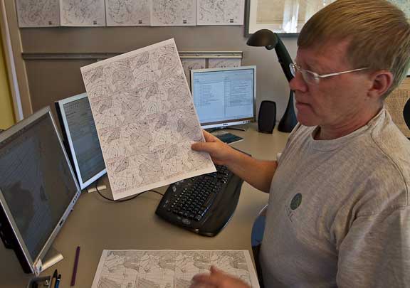
The Tromso waterfront is a hive of yachting activity, with fifteen or so yachts making preparations to depart for Svalbard. On Wind Horse we’ve been busy with provisioning, working with the arms race, and a few last minute systems checks. With departure day drawing near we hiked up to the Norwegian Met Service office to get a feel for ice and weather conditions in the near future, and to learn more about how the Met Service professionals do their jobs.
Nick Hughes is the manager of ice forecasting,
and Signe Alvarstein is the duty ice forecaster. They took us through the current ice conditions.

Their ice images are based on satellite radar data which comes from Canadian and European satellites. Radar has the advantage of seeing through the clouds, but the data then has to be interpreted as radar shows surface texture and you have to discern the difference between waves and ice.
The image above is of Svalbard.
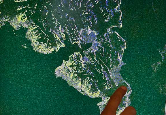
Signe is pointing to sea ice off the southeast corner of the island. This is one to two meter (three to six foot) thick and is first year (virgin) ice. The age of the ice tells us how hard it is. Older ice is harder, so this is as soft as it gets. Note that Hornsound, the large bay in the center of the photo, is presently clear. However, a moderate amount of northerly breeze could break this southeastern sea ice free and then it would be carried into Hornsound by the current which circulates clockwise around these islands.
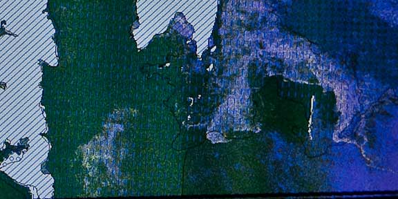
The bottom left of the photo above is the south corner of Svalbard. Note the sea ice off to the east (right) a ways off the coast, and well to the east in the blue area. Strong east winds would bring this into our cruising area.
A few general things we learned from Nick:
- This is an average ice year.
- The Arctic ice pack circulates with wind and current and with the right conditions will move south into the northern parts of Svalbard.
- Ice seems to be decreasing due to climate change.
- There has been little change the last five years.
- Climate change mechanisms are not well understood, but he doubts man has that much impact. More likely the mechanism has to do with the sun.
- Norwegian Bodo Radio broadcasts ice data in English over VHF and SSB at 1530 and 1930 Norwegian summer time.

Vidar Eng is the Senior Meteorologist, and gave us a quick heads up on general model behavior and how things compared to the more temperate climates.
To begin with, they have a Norwegian model which initializes based on the European (ECMW) model. His model has extremely high resolution, down to a kilometer. In the winter the temperature differential between the polar air masses and their warm coastal waters leads to explosive weather development (like continental lows coming off the US East Coast and hitting the Gulf Stream). In summer there is much lower risk of this occurring.
The same rules we are used to with 500mb weather impacting the surface also apply in the Norwegian Arctic.
As with forecasters in other areas, Vidar uses a variety of models, and looks at current wind and forecast winds at different altitudes.
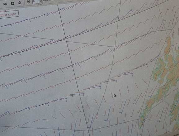
This is a wind plot at 10 and 30 meters. He will sometimes bump the surface forecast data based on what he sees at higher altitudes.
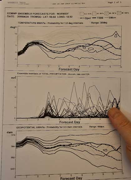
Forecasters and their customers are interested in the statistical reliability of their output. Vidar looks at each forecast and the variables to assess its reliability. In general, 48 hour data can be relied upon. 72 hours info is a little less, and anything beyond three days is OK for trend, but the detail should be suspect.
Key facts we learned that apply to our coming visit to Svalbard:
- The US GFS model, easily accessible with SailMail, is generally OK.
- 500 mb warning signals work the same as we are used to elsewhere.
- Winds today are favorable, and within the next 48 hours a small low will spin up to the east of our course (as forecast by GFS). This is likely to bring force 6 to 7 northwesterly winds. By Thursday it should be calm.
We will reevaluate tomorrow (Tuesday) and either leave in the afternoon, or head out as the low dissipates.
Posted by Steve Dashew (June 29, 2009)