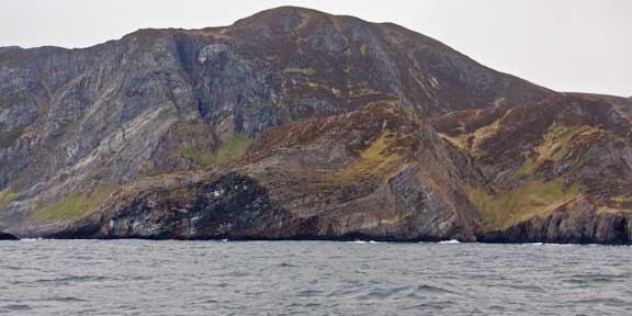
We’ve been hearing about the Norwegian coast around Statt for the past year. It has a fearsome reputation amongst commercial and amateurs alike. John Harries has warned us, several Brits who we met in the UK talked it up, and two local ship captains (most recently Per of who we spoke in the last blog) spoke of it with awe and respect. Sometimes reputations grow with telling. At other times they are earned with destruction and death. In this case, we can see how the latter applies.
There are a variety of factors which contribute to this situation.
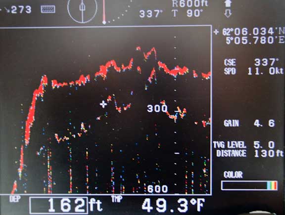
We’ll start with the sea bottom, a trace of which is shown above. Within a half a mile of shore the bottom suddenly shoals from a thousand or more feet (300m) to something even moderate sized swells can feel. This causes the swells to steepen and sometimes break.
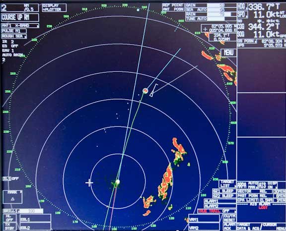
A radar image at the same time as the bottom trace, so you can see the proximity of the shoreline. Those big swells hit the shore and reflect back out to sea. Now you have the original humped up seas interacting with reflected waves.
Add in waves from several different directions – today we have swells from the southwest and northwest, and wind waves from the south – toss in a knot of two of current, and you have a diabolical, ship breaking brew.
We are out here 48 hours after the wind has subsided and it is still bouncy.
If a big sea is running, or weather is threatening, the safest route is outside, offshore in deep water. But then you are exposed for longer to the weather. For Wind Horse this is not such a problem because we can easily average our eleven knots, so we are at risk for less than three hours. Slower yachts need to be especially careful.
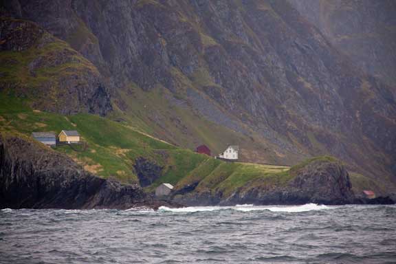
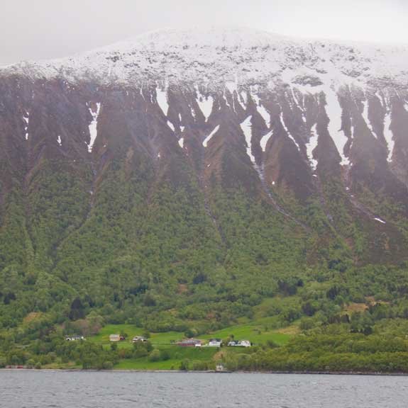
We continue to be amazed at the variety and quantity of homes, villages, and small towns. Many of these are in the most inhospitable locations imaginable, like those above adjacent to Statt.

With the rounding behind us we felt a treat was in order. This is the first bag of our meager store of healthy potato chips accompanied by a lovely fresh brewed pair of lattes.
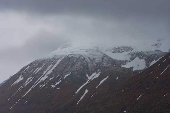
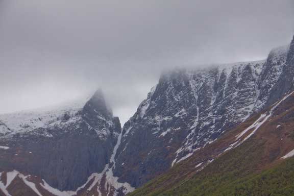
We are in fiord country now. There is more texture and contrast to the mountains, and a bit of snow which looks good even with this overcast.
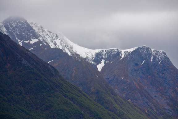
These images do not do justice to what we are seeing. But we are starting to feel the trip up this way is going to meet our expectations.
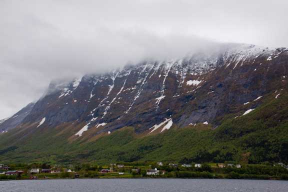
What is fascinating is how the Norwegians have been able to maintain these small settlements. In most economic/social systems they would not be practical. The costs of maintaining services and communications would be prohibitive.
But these folks have found a way to build roads, tunnels, bridges, and operate a ferry system without parallel for such widely spread out yet small population. And to provide schools and other social services.
North Sea oil, around now for fifty years, probably has a lot to do with it. That they have not wasted the proceeds is a tribute to the political system and electorate which holds the reins.
The Norwegian psyche has to play a big part as well. A lot of modern societies would spurn the charms and challenges of this rugged country side for the bright lights of urban centers.
Whatever the formula, don’t change it.
The barometer is up 30mb in the past 24 hours, to 1028, and we are promised fair skies and warm weather tomorrow.
Posted by Steve Dashew (May 11, 2009)
May 11th, 2009 at 10:25 pm
Any idea what the farmers in these “most inhospitable locations imaginable” grow or raise? My ancestors arrived on the Mayflower and I always wondered how they survived on the rocky soil and granite ledges. They must have gotten 100 tons of rock per acre. After all that is where New England’s rock fences came from.
Good to see you regular posts. I take it that your G3-SIM-dongle is working in places that I can’t imagine have good cell phone coverage. A friend from the UK got one of those before he took a vacation in the northern UK and it didn’t work anywhere.