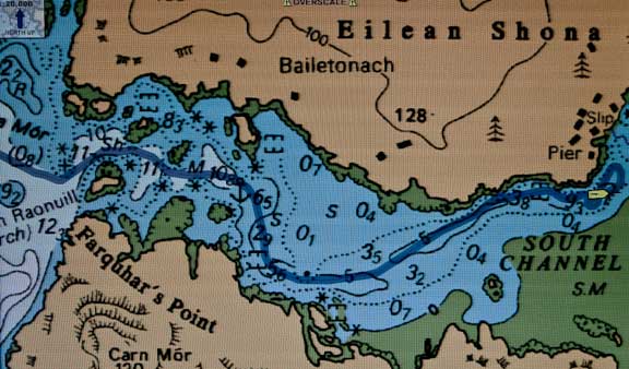
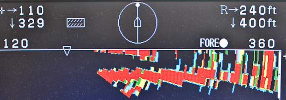
Loch Moidart is the type of cruising destination we look for. Beautiful surroundings, history, and navigational challenges to keep us sharp. As you can see from the chart above (the blue line represents our track) this is not an easy entrance. Depths are in meters (we draw 1.5m/five feet) and our entrance is an hour after high water, so we have almost four meters (13 feet) of positive tide. We are entering after high water for two reasons. First, this puts the current on our bow which makes steering easier. Second, if we go aground there will be a higher tide the next cycle to float us off. Winds are calm (we would not try this the first time in a breeze).
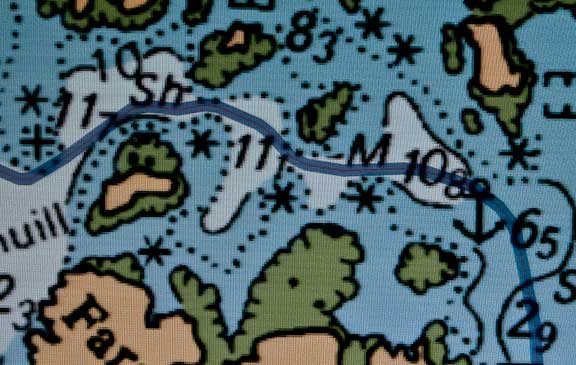
This is a detail of the entrance to Loch Moidart. Not much to go on for a first entrance, but surprisingly accurate. Without local knowledge, with a yacht the size of Wind Horse, we would not have attempted this without sonar. However, the Furuno CH270 sonar we have aboard kept us in the center of the track, with depths sufficient to allow us to exit even at low tide.
The tricky part came at the end, trying to find a place to anchor which would allow us to swing at low tide.
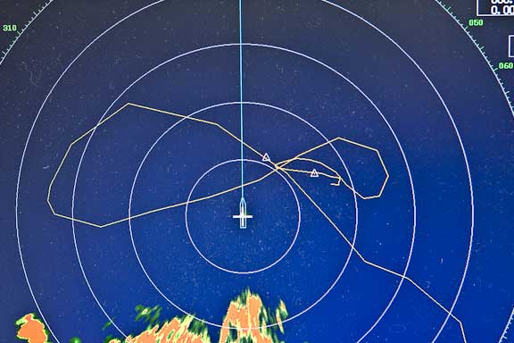
When we anchor we use the radar to plot where the anchor is dropped, and where we snug up the chain when setting in reverse (that is what the triangles represent). The yellow line is our track, and the orange target behind us is land. The radar is set to 1/8th nautical mile range and the range rings are 300 feet (90m) in diameter. The water is 32 feet (10m) deep at high tide, we set the anchor with 150 feet (45m) of chain, then shortened up to 120 feet (36m) after reversing on it. This photo and the next are taken the following morning, at high slack water, with the wind holding us in a position closest to shallow water (once the current starts to flow we will be aligned with the channel).

The shore looks a little close, so we light off the sonar to check.
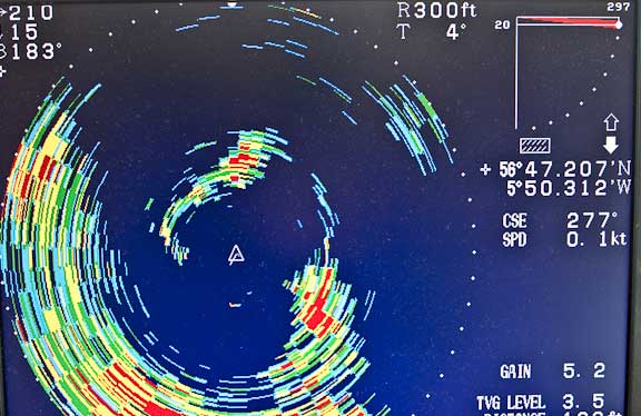
This is the horizontal view, with range set at 300 feet (90m). We are fine with the obstruction off our stern (starboard quarter), but concerned with the target on the bow.
Switching to vertical scan shows us the obstruction is something on the surface. Perhaps a shoal of fish, current shear line, or patch of fresh water. As it is not connected to the bottom this target is not a risk factor.
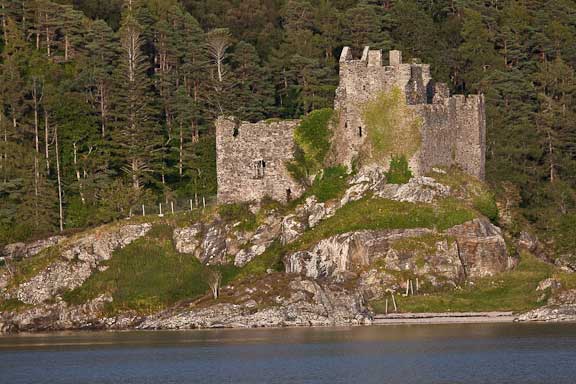
How’s this for anchorage ambiance? Castle Tioram, with a long and bloody history dating back at least 800 years (and maybe longer).
Our one lovely sunny day has given way to rain and clouds. The good news is we’ve got the deck drains open to catch fresh water. The better news is the GFS weather model shows the Azores High dominating in a day or two. We’ve got awnings ready to set.
Posted by Steve Dashew (August 8, 2009)