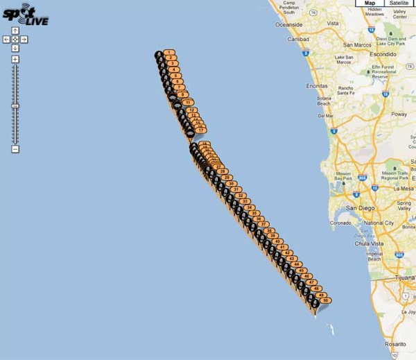
While we were away for a few days the news was full of “information” about the loss of a Hunter 37 and its crew in the Ensenada Race. This morning Todd Rickard mentioned that the Spot track for the Aegean was available on Sailing Anarchy, so we took a quick look.
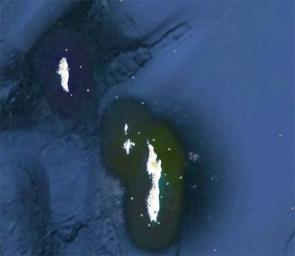
That track is headed straight for the north end of the Coronado Islands. Since we were not there, we cannot speculate on the atmospheric conditions or sea-state. Perhaps some SetSailors in the area will give us a heads up. What we do know is that there was close to half a moon that set around 0100 Sunday morning. News reports state that the skies were clear, in this often overcast and/or foggy part of the world. If it was clear, or nearly so, then the Coronado Islands would have been visible in moonlight from several miles off. The reports also credit the US Coast Guard with the comment that the swell was running six to eight feet.
The waters off San Diego, California, where this took place, are monitored on radar by the US Navy, which has a large base there, as well as the Customs and Border Protection Bureau. AIS is also monitored. If there was a ship near the track of the Aegean, it will have been recorded on both radar and AIS.
If you eliminate collision from the list of possible causes, it leaves explosion from an onboard source (possibly propane), a collision with a fishing vessel, or high speed drug runner, and hitting the Coronados. If the swell was six to eight feet, it could have destroyed a Hunter 37 in minutes on the rocks. Our guess is the latter.
As we learn more about this tragedy there are sure to be lessons for all of us.
Posted by Steve Dashew (May 1, 2012)