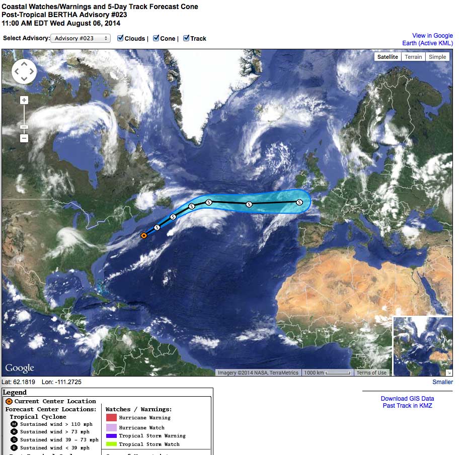
Hurricane Bertha has gotten a little press so far, but her evolution to extra-tropical structure indicates big things may be in store for the UK and parts of Europe.
Hurricanes are compact, rarely more than 40 miles across where their strong winds reside, and slow moving. As a result they are easy to dodge. When these leave the tropics and form extra-tropical lows, they move faster and cover ocean wide areas. Dodging is impossible, and the seas have a chance to grow. In short, the tropical structure becomes far more dangerous to vessels as it fades from the headlines.
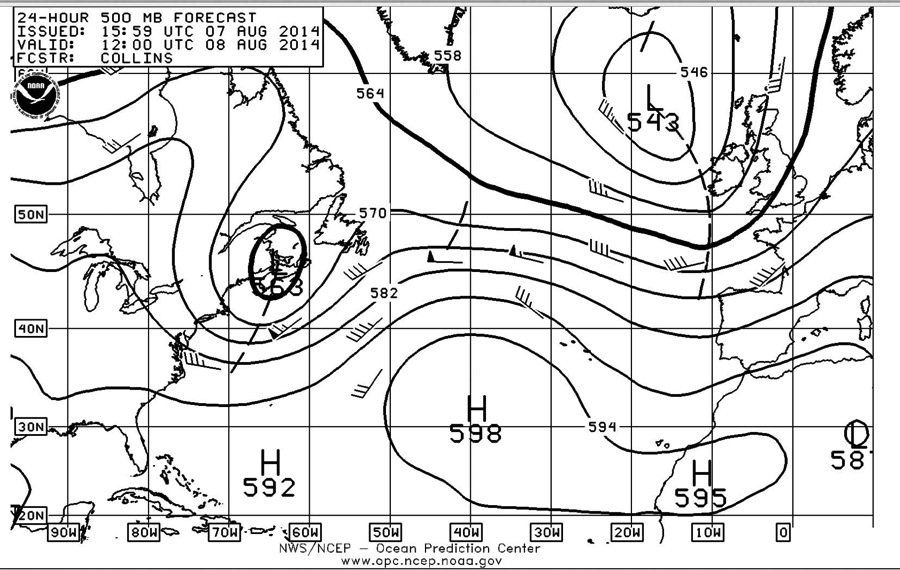
The key to evaluating the likelihood of this occurring is in the 500mb weather charts. Three days ago they were indicating a possible trip across the Atlantic for Bertha. The 24 hour forecast above shows the same. Check out http://www.opc.ncep.noaa.gov/shtml/A_brief.shtml for the complete N. Atlantic run of surface and 500mb data. This will be an interesting weather event. And for those who are afloat in Bertha’s extra-tropical path, keep a storm anchorage handy and extra ground tackle ready to go.
Posted by Steve Dashew (August 7, 2014)
August 7th, 2014 at 8:14 pm
Steve,
Did Bertha cause any problems for the east coast US?
I monitor this website daily (terrific resource):
http://earth.nullschool.net/#current/wind/surface/level/orthographic=-47.30,27.42,641
I hadn’t noticed it.
August 7th, 2014 at 11:53 pm
No contact with the US East coast for Bertha.
August 10th, 2014 at 3:36 am
The organisers of the Round Britain and Ireland Race, starting noon Sunday 10th, have decided to reverse the course to go anticlockwise around the isles for this reason. Sir Robin Knox-Johnston thought this was a good decision.
http://roundbritainandireland.rorc.org/newsblogsphotos/press-releases/271-running-with-bertha.html